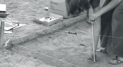
| Display title | File:Measuring elevation with a line level. Historical archaeology at the old Champoeg townsite, Champoeg, Oregon (USA) 1973 (2149089991) (cropped).jpg |
| Default sort key | Measuring elevation with a line level. Historical archaeology at the old Champoeg townsite, Champoeg, Oregon (USA) 1973 (2149089991) (cropped).jpg |
| Page length (in bytes) | 81 |
| Namespace | File |
| Page ID | 2260284 |
| Page content language | en - English |
| Page content model | wikitext |
| Indexing by robots | Allowed |
| Number of redirects to this page | 0 |
| Hash value | 0100ab693882c103365b6dd2c084716b1e7a77ec |
| Page image |  |
| HandWiki item ID | None |
| Edit | Allow all users (infinite) |
| Move | Allow all users (infinite) |
| Upload | Allow all users (infinite) |
| Page creator | Maintenance script (talk | contribs) |
| Date of page creation | 11:53, 22 March 2024 |
| Latest editor | Maintenance script (talk | contribs) |
| Date of latest edit | 11:53, 22 March 2024 |
| Total number of edits | 1 |
| Recent number of edits (within past 60 days) | 1 |
| Recent number of distinct authors | 1 |
| Transcluded template (1) | Template used on this page:
|

