File:Wilsons Promontory.png
From HandWiki
Size of this preview: 479 × 599 pixels. Other resolution: 505 × 632 pixels.
Original file (505 × 632 pixels, file size: 571 KB, MIME type: image/png)
Summary
| Description |
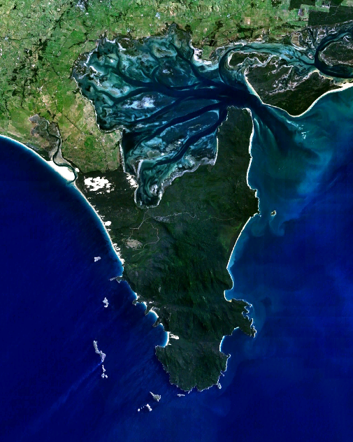
English: Wilsons Promontory, the southernmost point on the Australian mainland. |
| Date | 30 December 2005 (upload date) |
| Source | Satellite imagery taken from NASA World Wind software (by screenshot) |
| Author | NASA |
Licensing
| This image is in the public domain because it is a screenshot from NASA’s globe software World Wind using a public domain layer, such as Blue Marble, MODIS, Landsat, SRTM, USGS or GLOBE.
|
 |
File history
Click on a date/time to view the file as it appeared at that time.
| Date/Time | Thumbnail | Dimensions | User | Comment | |
|---|---|---|---|---|---|
| current | 23:54, 29 December 2005 | | 505 × 632 (571 KB) | imagescommonswiki>Stephen Bain | w:Wilsons Promontory, the southernmost point on the Australian mainland. {{PD-WorldWind}} |
File usage
The following file is a duplicate of this file (more details):
- File:Wilsons Promontory.png from Wikimedia Commons
The following page uses this file:

