File:Map-AustroPrussianWar-annexed.svg
From HandWiki

Size of this PNG preview of this SVG file: 646 × 600 pixels. Other resolution: 517 × 480 pixels.
Original file (SVG file, nominally 1,697 × 1,576 pixels, file size: 755 KB)
Summary
| Description |
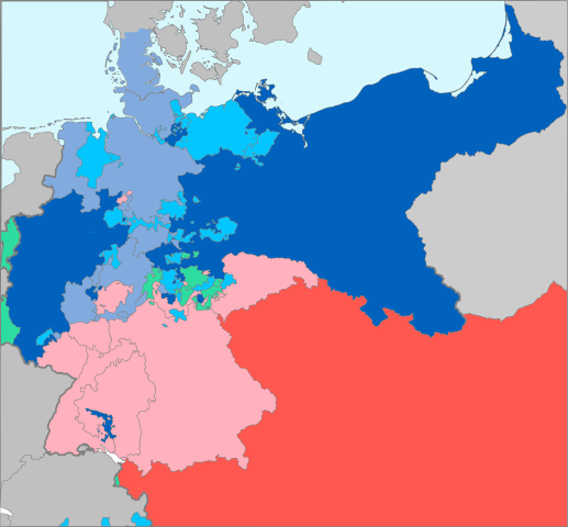
Deutsch: Preußische Annexionen nach dem Deutschen Krieg von 1866:
English: Aftermath of the Austro-Prussian War (1866):
Français : Conséquences de la guerre austro-prussienne de 1866 :
|
| Date | |
| Source | Based on map data of the IEG-Maps project (Andreas Kunz, B. Johnen and Joachim Robert Moeschl: University of Mainz) - http://www.ieg-maps.uni-mainz.de |
| Author | User:52 Pickup |
| Permission (Reusing this file) |
This file is licensed under the Creative Commons Attribution-Share Alike 2.5 Generic license.
|
File history
Click on a date/time to view the file as it appeared at that time.
| Date/Time | Thumbnail | Dimensions | User | Comment | |
|---|---|---|---|---|---|
| current | 07:20, 12 November 2016 | | 1,697 × 1,576 (755 KB) | imagescommonswiki>Furfur | Farbe vereinheitlicht, Korrekturen: Krakau, Lauenburg |
File usage
The following file is a duplicate of this file (more details):
- File:Map-AustroPrussianWar-annexed.svg from Wikimedia Commons
The following page uses this file:

