File:Leefgebied Puku-Kobus vardonii.png
From HandWiki

Size of this preview: 600 × 600 pixels. Other resolutions: 480 × 480 pixels | 2,000 × 2,000 pixels.
Original file (2,000 × 2,000 pixels, file size: 251 KB, MIME type: image/png)
| Description |
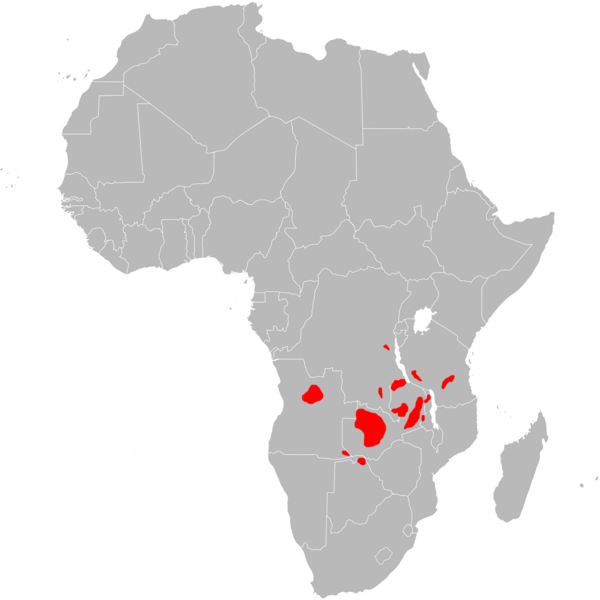
English: Range map of Puku.
עברית: מפת תפוצה של פוקו. |
||
| Date | |||
| Source | Image:BlankMap-Africa.svg, information from [1] | ||
| Author | User:Gilado (blank map by User:Lokal_Profil and User:Canuckguy) | ||
| Permission (Reusing this file) |
|
File history
Click on a date/time to view the file as it appeared at that time.
| Date/Time | Thumbnail | Dimensions | User | Comment | |
|---|---|---|---|---|---|
| current | 16:27, 1 April 2018 | | 2,000 × 2,000 (251 KB) | imagescommonswiki>Maphobbyist | South Sudan border |
File usage
The following file is a duplicate of this file (more details):
- File:Leefgebied Puku-Kobus vardonii.png from Wikimedia Commons
The following page uses this file:

