File:Iraqi Civil War map (2014–present).png
From HandWiki
Size of this preview: 586 × 599 pixels. Other resolutions: 469 × 480 pixels | 3,360 × 3,436 pixels.
Original file (3,360 × 3,436 pixels, file size: 821 KB, MIME type: image/png)
See also : Category:Conflicts by country
Summary

|
This file may be updated to reflect new information. If you wish to use a specific version of the file without new updates being mirrored, please upload the required version as a separate file. |
| Description |
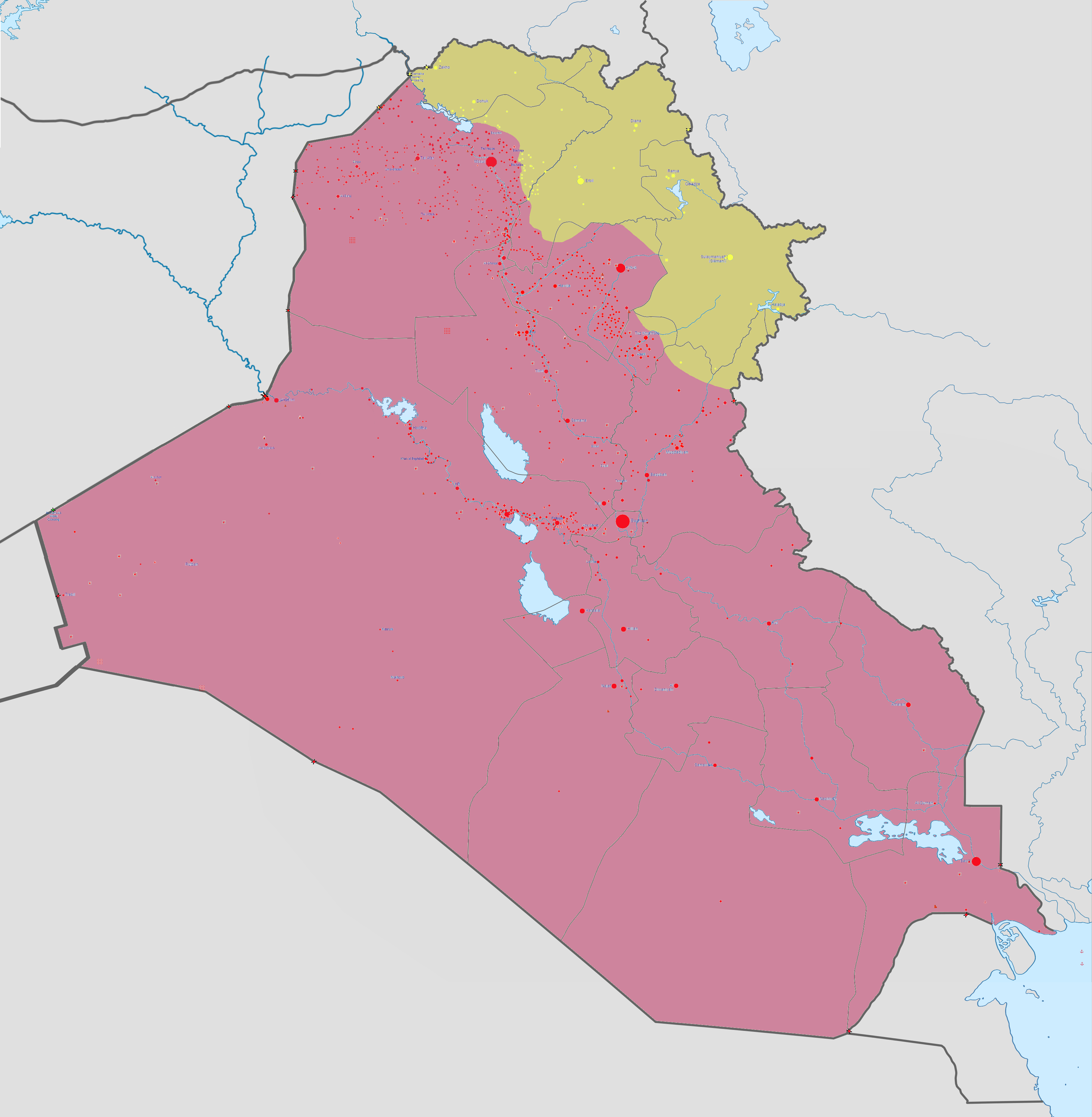
Català: Mapa de la guerra d'Iraq Controlat pel govern
Controlat per l'IS Controlat pels kurds Deutsch: Karte des Bürgerkrieges im Irak.
Kontrolliert von der Irakischen Regierung Kontrolliert vom Islamischen Staat (IS, Daesch, ISIS, ISIL) Kontrolliert durch die irakischen Kurden English: Map of the Second Iraqi War. After updating this map, please also update the date(s) at w:Module:Iraq Syria map date, used to denote the date in articles.
Controlled by the Iraqi Government Controlled by ISIS Controlled by Peshmerga (Kurdistan Regional Government) and other Kurdish forces from the Kurdistan Region Español: Mapa de la guerra of the insurgencia iraquí.
Controlado por el gobierno iraquí. Controlado por el Estado Islámico de Irak y el Levante Controlado por el Peshmerga Français : Carte actualisée de l'actuelle guerre d'Irak. Русский: Карта Гражданской войны в Ираке
Контролируется иракским правительством Контролируется Исламским государством (ИГ, ИГИЛ) Контролируется иракскими курдами |
||||
| Date | |||||
| Source |
Own work |
||||
| Author | Absalao777 | ||||
| Other versions |
|


.png)


.svg)


.svg)

.svg)


_Territory_Change_2014-2016.gif)

_(within_Northern_Syria).svg)


.png)
.svg)


_map.png)
.svg)


.svg)


|
File:Iraqi Civil War map (2014–present).svg is a vector version of this file. It should be used in place of this PNG file when not inferior.
File:Iraqi Civil War map (2014–present).png → File:Iraqi Civil War map (2014–present).svg
For more information, see Help:SVG. |
.svg) |
Licensing
I, the copyright holder of this work, hereby publish it under the following license:
This file is licensed under the Creative Commons Attribution-Share Alike 3.0 Unported license.
- You are free:
- to share – to copy, distribute and transmit the work
- to remix – to adapt the work
- Under the following conditions:
- attribution – You must give appropriate credit, provide a link to the license, and indicate if changes were made. You may do so in any reasonable manner, but not in any way that suggests the licensor endorses you or your use.
- share alike – If you remix, transform, or build upon the material, you must distribute your contributions under the same or compatible license as the original.
File history
Click on a date/time to view the file as it appeared at that time.
| Date/Time | Thumbnail | Dimensions | User | Comment | |
|---|---|---|---|---|---|
| current | 14:12, 17 March 2019 | | 3,360 × 3,436 (821 KB) | imagescommonswiki>Enterlousy | Slightly fixed Iraq. |
File usage
The following file is a duplicate of this file (more details):
- File:Iraqi Civil War map (2014–present).png from Wikimedia Commons
The following 2 pages use this file:


.png)
.png&action=edit&redlink=1)
.png)
.png&action=mzwi)
.png)
.png)
.png)
.png&action=info)