File:ISS012-E-23610 NASA Savai'i and Upolu.jpg
From HandWiki

Size of this preview: 800 × 531 pixels. Other resolutions: 640 × 424 pixels | 3,040 × 2,016 pixels.
Original file (3,040 × 2,016 pixels, file size: 3.12 MB, MIME type: image/jpeg)
Summary
| Description |
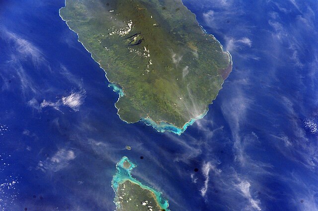
English: Samoa islands, Savai'i & Upolu with Manono and Apolima in the Apolima Strait. NASA spacecraft altitude 188 nautical miles (348 km). |
| Date | |
| Source | Image Science and Analysis Laboratory, NASA-Johnson Space Center. "The Gateway to Astronaut Photography of Earth." < http://eol.jsc.nasa.gov/scripts/sseop/QuickView.pl?directory=ESC&ID=ISS012-E-23610> |
| Author | NASA *uploaded by Teinesavaii |
| Camera location | | View this and other nearby images on: OpenStreetMap |
|---|
Licensing
This file is in the public domain in the United States because it was created by the Image Science & Analysis Laboratory, of the NASA Johnson Space Center. NASA copyright policy states that "NASA material is not protected by copyright unless noted". (NASA media use guidelines or Conditions of Use of Astronaut Photographs).
Photo source: ISS012-E-23610.
|
File history
Click on a date/time to view the file as it appeared at that time.
| Date/Time | Thumbnail | Dimensions | User | Comment | |
|---|---|---|---|---|---|
| current | 16:38, 23 May 2013 | | 3,040 × 2,016 (3.12 MB) | imagescommonswiki>Ras67 | new rendered from NASA's raw image data |
File usage
The following file is a duplicate of this file (more details):
- File:ISS012-E-23610 NASA Savai'i and Upolu.jpg from Wikimedia Commons
The following 2 pages use this file:

