File:Glyphosate USA 2019.png
From HandWiki
Size of this preview: 462 × 600 pixels. Other resolutions: 370 × 480 pixels | 1,166 × 1,514 pixels.
Original file (1,166 × 1,514 pixels, file size: 898 KB, MIME type: image/png)
Summary
| Description |
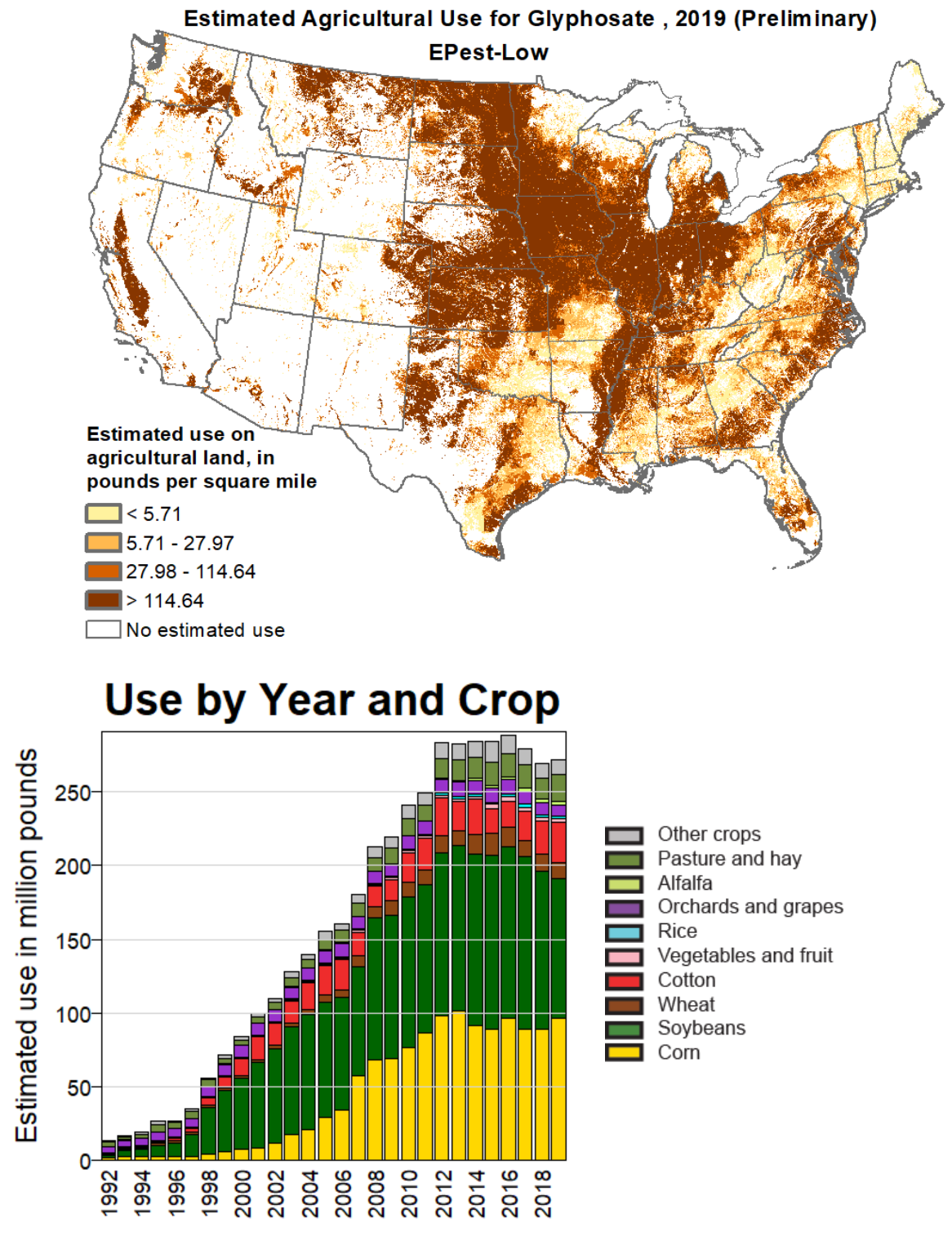
English: Map of the estimated use of the herbicide glyphosate in the United States in 2019 and graph showing annual use since 1992 |
| Date | |
| Source | https://water.usgs.gov/nawqa/pnsp/usage/maps/show_map.php?year=2019&map=GLYPHOSATE&hilo=L&disp=Glyphosate |
| Author | United States Geological Survey |
Licensing
This image is in the public domain in the United States because it only contains materials that originally came from the United States Geological Survey, an agency of the United States Department of the Interior. For more information, see the official USGS copyright policy.
|
File history
Click on a date/time to view the file as it appeared at that time.
| Date/Time | Thumbnail | Dimensions | User | Comment | |
|---|---|---|---|---|---|
| current | 11:12, 14 December 2023 | | 1,166 × 1,514 (898 KB) | imagescommonswiki>Smartse | Uploaded a work by United States Geological Survey from https://water.usgs.gov/nawqa/pnsp/usage/maps/show_map.php?year=2019&map=GLYPHOSATE&hilo=L&disp=Glyphosate with UploadWizard |
File usage
The following file is a duplicate of this file (more details):
- File:Glyphosate USA 2019.png from Wikimedia Commons
The following page uses this file:

